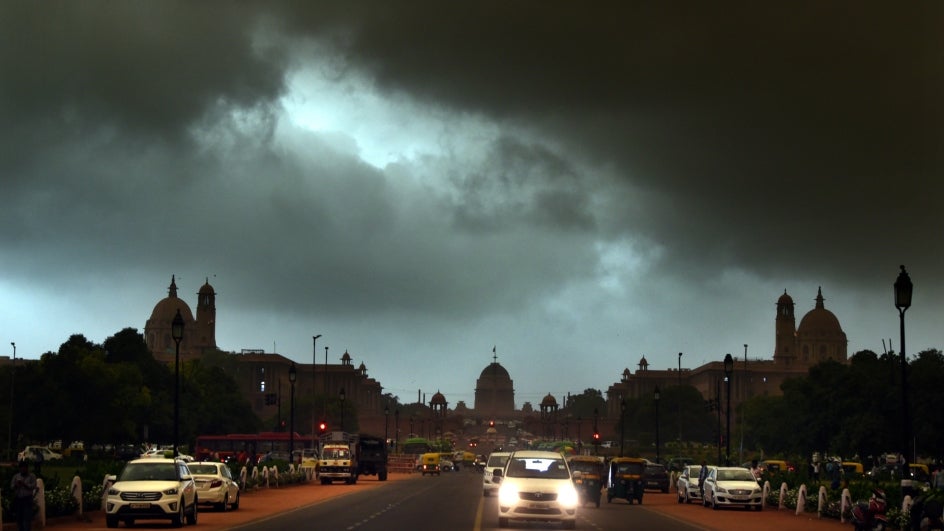
The south-west monsoon has slowed, and the India Meteorological Department (IMD) said on Sunday that it is unlikely to make onset over Delhi, Haryana, and Chandigarh, or advance into the remaining parts of Punjab, western Uttar Pradesh, and Rajasthan in the next five days.
Due to a low pressure system building up over the Bay of Bengal, the weather department previously predicted that the south-west monsoon would reach Delhi and most of north-west India by June 15, almost a fortnight ahead of schedule. However, the monsoon’s advance over the region was now being slowed by a dominant westerly wind pattern.
“Further advance of south-west monsoon into remaining parts of Rajasthan, West Uttar Pradesh, Haryana, Chandigarh, Delhi and Punjab is likely to be slow as large-scale features are not favourable and the forecast wind pattern by the numerical models do not indicate any favourable condition for sustained rainfall over the region during the forecast period,” IMD said in its bulletin on Sunday.
From June 1 to June 20, the country received 41% more rain than usual. According to IMD data, despite the fact that the monsoon did not arrive in many parts of the country as expected, there was an excess of 83 percent rain in north-west India, 67 percent in central India, 28 percent in the south peninsula, and 12 percent in the east and north-east regions.
The monsoon moved into Gujarat, Madhya Pradesh, and western Uttar Pradesh on Saturday. Barmer, Bhilwara, Dholpur, Aligarh, Meerut, Ambala, and Amritsar were all in the path of the south-west monsoon’s northern limit.
“For the next five days, we are not expecting the monsoon to make onset over Delhi and its neighbouring areas. This is mainly because of the westerly wind pattern which is weakening the monsoon flow. In fact, monsoon rains may start reducing over the west coast gradually mainly because no low pressure system or depression is developing over Bay of Bengal. Parts of Gujarat and Rajasthan, however, are getting very good rains now because of an interaction with westerlies. Models are presently not indicating favourable conditions for monsoon advance. We will be able to inform on the onset status after five days,” said RK Jenamani, senior scientist, National Weather Forecasting Centre.
IMD predicts widespread rainfall over east Uttar Pradesh and Bihar over the next 24 hours, followed by a significant reduction in rainfall activity. It also said that widespread rain, with isolated heavy rain, is very likely over Uttarakhand in the next 24 hours.
“At the moment, we cannot say when the monsoon will arrive over Delhi. Rainfall is likely to decrease from tomorrow over the region because of a trough in the westerlies. It will slow down the movement of easterly winds. Monsoon has already covered parts of west Uttar Pradesh; only Mathura, Bulandshahr, etc, are left. So once monsoon advances, it will cover Delhi also,” said Kuldeep Srivastava, head, regional weather forecasting centre.
On June 3 this year, the south-west monsoon arrived two days late at Kerala’s coast, but it quickly picked up speed and began sweeping across the country several days ahead of schedule.
Experts previously predicted that it would cover the entire country about a fortnight before its normal July 8 date.
It did, however, slow down over western Uttar Pradesh later, delaying the advance into Delhi.


