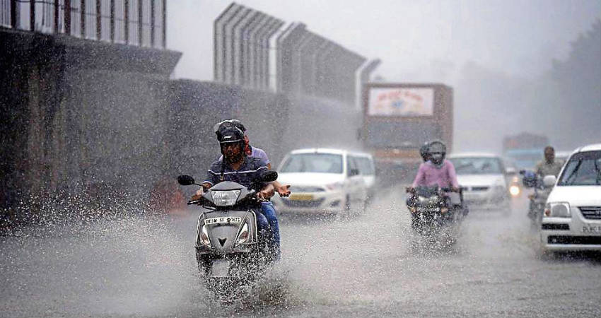
In just three three-hour spells, Delhi made up 83 percent of its August rainfall deficit, two on August 21 and one on August 31. However, it did not rain in the national capital on 15 of August’s 31 days, the wettest month of the monsoon season. This could be the new trend in India, where short, intense rainstorms are replacing uniformly distributed rainfall. Even this phenomenon, however, has several regional variations.
1) The monsoon this year demonstrates how rainfall patterns are shifting.
Rainfall is measured by the India Meteorological Department (IMD) by comparing it to the average rainfall for that interval from 1961 to 2010. The Long Period Average is another name for this (LPA). Cumulative rainfall this year has stabilised in the normal range after the first month of the monsoon season (June-September). A deviation of up to 20% on either side of LPA is considered normal, a positive deviation of 20% or more is considered an excess, and a negative deviation of 20% or more is considered deficient rainfall by IMD. With less than a month until the season ends, this year’s monsoon is likely to be normal. Averages, on the other hand, hide details, rather than ups and downs. According to scientists, this trend will likely become more pronounced as a result of the climate crisis. Rainfall was deficient on 34 days during the 92 days of monsoon from August 1 to August 31, with deficits ranging from 20% to 61 percent. However, 24 days of excess rainfall have made up for much of the deficit, with surpluses ranging from 23 percent to 93 percent.
2) Rain is falling on fewer days these days.
During the 2011-2020 decade, there were five years with an unusually high number of days with a lot of rain. If years are ranked by the number of days in the year that fall within the top 10% of the monsoon’s highest rainfall days since 1901, 2019 comes in first with 30 days. Four more years (2011, 2013, 2016, and 2020) are included in the top 50. 2014 and 2017 are ranked 51st and 52nd, respectively. There have been five days in the top decile of highest rainfall since August 31, 2021. Long dry spells are also common on days with high rainfall. Fifty percent of monsoon rains now arrive in fewer days. This has decreased from 41.34 days (average from 1961 to 2010) to 40.9 days at the national level (average in 2011-2020). This change is greater in several northern and north-eastern states, such as Bihar, where it went from 21.74 days to 19.4 days, and Manipur, where it went from 20.54 days to 16.7 days. In total, the number of days it takes for 50 percent of monsoon rains to fall has decreased in 19 of 29 states (including Delhi). In addition, the number of days it takes for 99 percent of the monsoon to arrive has decreased in 24 states.
3) In most places, there are fewer rainy days and more intense rain.
Rainfall is not necessarily becoming more intense just because there are fewer days of rain. It can also refer to a location’s dehydration. As a result, rainfall days and intensity must be read together. While the number of days required for 50 percent rainfall has decreased in most states (all states to the left of the vertical line in the chart below), heavy and extreme intensity rainfall has not increased in Assam, Bihar, Jharkhand, West Bengal, and Uttar Pradesh (more than 35.5mm in a grid in a day). In this case, fewer rainy days have likely resulted in the states becoming drier. In most western and southern states, heavy and extreme rainfall has increased (all states above horizontal line). Those in the top-left quadrant, where the number of rainfall days has decreased, are likely to experience prolonged dry spells followed by intense wet spells. A more uniform distribution is likely to be seen where rainfall days have increased (top-right quadrant). However, this is not the case in Gujarat and Rajasthan this year, where long dry spells have resulted from a break phase in both states.


